Undergraduate programs
We are intrepid explorers
Do you have a passion for adventure? Are you happy exploring anything from mountains to coastlines? Ready to head into the wilderness and see what you can find?
Do you like your adventures on a computer while you harness data to address human needs? All of this and more is part of geomatics engineering.
We offer one of only two accredited geomatics programs in Canada and are known for our quality teaching and pioneering research.
This is the kind of work you could do as a geomatics engineer:
- get a measure on things through land surveying
- test the navigation system on a submarine in a remote fiord
- enable planning of smart cities
- develop software with GIS
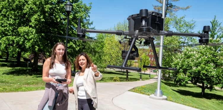
- map the Earth with drones and satellites
- chart the depths of the ocean
- monitor climate change with GNSS
- produce 3D models of historical buildings for preservation
- use advanced instruments to ensure construction project safety
Join us as we explore the world and create technologies that improve lives.
GGE defined
Geodesy
Geodesy is the science that underlies geomatics. It deals with the fundamentals of measurement and representation of the geometry and gravity field of the Earth including their variations over time. Focus on geodesy and you could study geodynamic phenomena such as crustal motion, solid earth tides, and polar motion.
There are a wide range of essential applications of geodesy. You could monitor sea-level variations, earthquakes, volcanoes and tsunamis. You could apply it to planets in outer space or create better systems for positioning here on Earth.
Geomatics
Do you know what GPS, Google Earth, smartphones and 3D movies have in common? They are all based on geomatics technologies.
Geomatics incorporates art, science and technology to collect, process, manage and display geo-referenced information. It includes the fields of land administration, geodesy, global navigation satellite systems (GNSS), surveying, geographical informational systems (GIS), remote sensing, photogrammetry and hydrography. They are often integrated with one another.
Geomatics is also a growing industry that deals with spatially referenced information. The global geomatics market was worth 7.35 billion US dollars in 2022. Over the next ten years it is expected to grow by over 10%*. That means career options for UNB Geomatics graduates. A degree in geomatics can take you on unforgettable adventures.
*information from Spherical Insights on the global geomatics market
Choose your program duration and focus
- a four-year engineering bachelor's degree (BScE) in geomatics engineering
- a three-year non-engineering bachelor's degree in geomatics (BGeom)
- a two-year customizable diploma (D-GGE) in geomatics
- a minor in geomatics to be added to another degree
- individual courses to develop professionally or satisfy a yearning to know more
- options for off-campus study through GGE Remote — learn more here
Program options
The coordinates for your approach to geomatics and geodesy can be customized to suit your career goals.
GGE 4-year BScE
Cadastral Surveying - optional specialization
Establish the boundaries with the cadastral surveying specialization. Gather and analyze the data to define parcels of land and sites with precision. Build the spatial fabric of human society. Contribute to mapping on land or under water. Make your mark through the mathematics of location and place.
This program meets the requirements for the Canadian Board of Examiners for Professional Surveyors (CBEPS). Qualify for accreditation, after an apprenticeship, as a professional surveyor when done.
Hydrographic Surveying - optional specialization
Dip your toes into the hydrographic surveying specialization. Surveying under the ocean is essential for science and climate adaptation as well as harvesting resources from the seafloor. Complete the required technical courses and you will get a designation on your transcript.
This option is accredited as a Category S5-A level program by the International Hydrographic Organization (IHO). If you focus on this specialization you will be qualified to work anywhere your imagination takes you.
3-year BGeom
Non-engineering degree
Get working sooner with the 3-year BGeom. Launch into a surveying career with the CBEPS accredited cadastral surveying option. Course credit is available from geomatics engineering technology diplomas or other prior studies for other bachelor degrees. You can study remote sensing, GIS, GPS, ocean mapping, and land management with ample employment opportunities afterward.
2-year D-GGE
GGE diploma
Here you can specialize and focus on topics you love. Build your own diploma or choose from specializations including:
- cadastral studies
- engineering and exploration surveying
- geodetic surveying
- land information management
- mapping and geographic information systems
The diploma is a great way to develop professional competencies or cross off CBEPS exemptions.
Minor in Geomatics
Do you want to study in another program but still work on your passion for geospatial information? Geomatics is a great pairing with civil engineering, Earth sciences, computer science, sociology, and many other disciplines. Here too you can specialize in:
- land administration and information management
- mapping and geographic information systems
- hydrography and oceanography
- positioning
- or build a minor fit for you
Develop entrepreneurial skills by adding the TME diploma to your studies. You can apply all of your learning and skills to advance your career with co-op.
- Diploma in Technology Management and Entrepreneurship (TME)
- Co-op designation with co-op work terms in the Co-op Program
Your future after a GGE degree
Geodesy and Geomatics is a quickly-growing field. These are just a few of the career options open to you.
Global Navigation Satellite Systems
Whether by land, sea or air, people have to know where they are and where they are going. Global navigation satellite systems (GNSS) including GPS, are key to moving goods and people. High in the sky, GPS satellites transmit radiowave signals to be received by GPS antennas and receivers in our phones, cars, airplanes and ships. Advanced GPS applications allow increasing precision to position and navigate including in land surveys and in offshore uses.
You could work to measure the movement of tectonic plates or calculate atmosphere temperature profiles to help with climate change data. Detect volcanic eruptions in remote areas to warn local populations. Study space-weather impacts on telecommunication infrastructure. Or work on more down-to-earth applications like vehicle navigation or improved GNSS in cities.
Satellite imaging
This kind of remote sensing is used to solve many different geo-related problems. You could identify wildfires or oil spills. You might monitor river flooding or map possible nuclear weapon sites.
If you look at a satellite image in Google, it has been processed to be more usable. UNB faculty and researchers have been working for decades on techniques to improve satellite images. All geo-related disciplines need remote sensing professionals.
With these skills you could work in:
- geomatics
- civil engineering
- environmental sciences
- geology
- forestry
- agriculture
- natural resources
- defense and security
Ocean mapping
Do you need to build an offshore wind farm? This project and others require ocean floor mapping. Hydrographic surveying involves measuring, detecting and describing features on the sea floor that affect marine construction and navigation.
You could do 3D maps of the seafloor to distinguish offshore boundaries. Identify tides and currents that could affect the construction of bridges and other offshore construction. This makes construction activities safer for people and the environment. UNB Geomatics leads the way with the Ocean Mapping Group and research into hydrographic surveying.
GIS - Geographic Information Systems
Do you love to analyze geographic data? You can take raw data and transform it into useful information for many different disciplines. Geographic Information Systems (GIS) are computer-based systems that capture, store, manage, analyze and present all types of geographic data.
Eight per cent of all data that we record and analyze contains some geographical reference. As humans we exist in time and space. Bringing these quantities to bear leads to better decisions and helps us find our place in the world. GIS expertise is in demand from public and private sectors.
With GIS you can contribute to:
- urban planning and management
- resource exploration
- environmental management
- archeology
- land use studies
Laser scanning applications
Step into the latest technology for gathering information about the Earth's surface, buildings and infrastructure. Collect 3D information with laser scanning, then use digital processing and analysis to make that information useful to others. Laser scanning is used to:
- monitor dams and bridges
- plan for modifications to industrial plants
- create detailed imagines of modern and historical buildings and artifacts
- determine volumes for excavation
- record accidents and crime scenes
- assess risk from flooding, study river beds and valleys
- track the growth patterns in forests
Land surveys
Engineering surveys
Be the person who is essential to any civil, mining and geotechnical project in all stages. Help position and monitor for structural stability of large dams, bridges, and tunnels. Make sure development happens responsibly and safely. Your skills are critical in:
- planning
- construction
- operation of large projects
- safety monitoring of infrastructure
- disaster prevention and mitigation
Aerial surveying
Analyze aerial photographs and electromagnetic images to know reliably what is on the ground. Fly away and gather data for road construction, power line construction, and other projects. Or examine the images to get reliable information beyond what the human eye can see.
Photogrammetry enables topographic mapping, land inventory, and terrain modeling. You could create 3D models of the surface of the Earth to understand ground elevations. Gather, store, analyze, manipulate and display the information so that others can make safe and useful decisions about many kinds of projects.
Land administration and management
Surveying might establish land boundaries but those boundaries must be managed. Land administration systems may be formal or informal but like good fences, they help ensure good neighbours. Your work might include:
- ensuring smooth transfer of land ownership
- regulating property development
- enforcing the sustainable use of land
- resolving current or potential ownership conflicts
Geodetic surveying
Are you a really precise person? Geodetic engineering may be your way to a great career. It uses the principles of geodesy to solve problems, from industrial requirements to the Earth sciences, and allows us to pinpoint locations. With coordinate referencing systems, geodetic surveying can locate property boundaries, create maps and position construction projects to the highest precision.