Recent webinars available for viewing:
Forests, Floods, and Climate Change along the Wolastoq Webinar
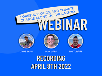 Three graduate students in the Master of Environmental Management program at the University of New Brunswick host a discussion about forests, floods, and climate change along the Wolastoq. They discuss ongoing research in general terms and present how the results are applicable to community members in New Brunswick, especially in climate change mitigation efforts. This is a recording of a live webinar that occurred on April 8th, 2022, on Microsoft Teams.
Forêts, inondations et changement climatique le long du Wolastoq Webinar
 Trois étudiants diplômés de l'Université du Nouveau-Brunswick animent une discussion sur les forêts, les inondations et les changements climatiques le long du Wolastoq. Ils discutent de la recherche en cours en termes généraux et présentent comment les résultats sont applicables aux membres de la communauté au Nouveau-Brunswick, en particulier dans les efforts d'atténuation des changements climatiques. Ceci est un enregistrement d'un webinaire en direct qui a eu lieu le 8 avril 2022 sur Microsoft Teams.
Best Management Practices: Using Climate and Hydrology Tools along the Wolastoq
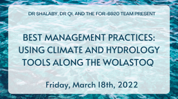 Researchers from the University of New Brunswick and the University of Maryland explain how their research can inform best management practices along the Upper St. John Basin (Wolastoq). This webinar was hosted by three Masters students in Environmental Management from the University of New Brunswick. A big “thank you” to Dr. Ahmed Shalaby and Dr. Junyu Qi for taking the time to participate in the webinar.
Meilleure gestion: utilisant des outils climatiques et hydrologiques sur la Wolastoq
 Des chercheurs de l'Université du Nouveau-Brunswick et de l'Université du Maryland expliquent comment leurs recherches peuvent éclairer les meilleures pratiques de gestion le long du bassin supérieur du Saint-Jean (Wolastoq). Ce webinaire a été animé par trois étudiants à la maîtrise en gestion de l'environnement de l'Université du Nouveau-Brunswick. Un grand "merci" au Dr Ahmed Shalaby et au Dr Junyu Qi d'avoir pris le temps de participer au webinaire.
Maritime Climate Modelling & Upper Wolastoq Water Assessment Webinar
 •Researchers from the University of New Brunswick and the University of Maryland present their research on the environmental factors modifying water flow in the Upper St. John (Wolastoq) Basin. Topics covered include nutrient point sources, regional climate modelling, and assessment tools like WetSpa and SWAT. This webinar was organized by three Master of Environmental Management students at the University of New Brunswick. A big “Thank You” to Dr. Charles Bourque, Dr. Ahmed Shalaby, and Dr. Junyu Qi for taking the time to participate in the webinar.
Modélisation du climat maritime et l’évaluation des eaux de la cours supérieure du fleuve Wolastoq
 •Des chercheurs de l'Université du Nouveau-Brunswick et de l'Université du Maryland présentent leurs recherches sur les facteurs environnementaux modifiant le débit d'eau dans le bassin supérieur de St. John (Wolastoq). Les sujets abordés comprennent les sources ponctuelles de nutriments, la modélisation du climat régional et les outils d'évaluation comme WetSpa et SWAT. Ce webinaire a été organisé par trois étudiants à la maîtrise en gestion environnementale de l'Université du Nouveau-Brunswick. Un grand « merci » au Dr Charles Bourque, au Dr Ahmed Shalaby et au Dr Junyu Qi d'avoir pris le temps de participer au webinaire.
Climate Change and Water Analysis in the Upper Wolastoq Basin
 • A summary of regional climate change modelling and ongoing research regarding water flow and quality in the Wolastoq/St. John River. Research and tools developed by researchers in the University of New Brunswick Faculty of Forestry and Environmental Management.
Lower Wolastoq Flooding Assets Map
Background flood risk map with critical, cultural, natural, and transportation assets included for flood mitigation planning. These layers are editable, meaning locations can be added using coordinate data from Google Maps or any other service that uses WGS 1984 datum as a spatial reference.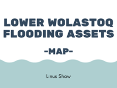
This map was not created as a component of this specific research project, but it is being included on this website as a tool that displays the flood risk along the Lower Wolastoq. We know that what occurs upstream influences the whole river downstream of the study area, and the map allows the public to visualize that relationship and see how the river may affect critical, cultural, natural, and/or transportation assets. Although it is not inherently connected with the upriver research, it is pertinent information for the downriver communities as it relates to flood mitigation planning.