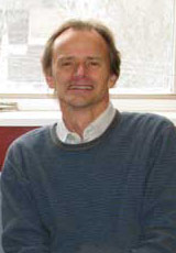
Peter Dare

Professor
PhD; P.Eng.
Geodesy and Geomatics Engineering
Head Hall E54A
Fredericton
Dr. Peter Dare joined the University of New Brunswick (UNB), Department of Geodesy and Geomatics Engineering in August 2000. Dr. Dare is a member of a number of worldwide professional institutions and committees. Since joining UNB, Dr. Dare has spent some time with a major international project at a World Heritage Site in Turkmenistan. His role was to create a base map through a combination of GPS and space imagery.
Previously, while at the The School of Surveying at the University of East London (UEL) he established a new research unit: the Applied Geodesy Research Unit (AGRU). With Dr. Dare as its director, Dr. Frank Hobbs as the assistant director and three post graduate students attached to the unit AGRU aimed to be at the forefront of applied geodesy.
Individually, members of AGRU established close links with industry both in the UK and elsewhere around the world. For example:
- The Mapping Unit of Malta
- The Ministry of Housing, Lands, Town and Country Planning in Mauritius
- The Ministry of Land Use and Habitat in Seychelles
All the above have benefited from GPS work carried out to improve their networks. In addition, the Museum of London Archaeology Service and the Essex County Council have worked closely with members of AGRU on the application of GPS to improve their field procedures. Survey work in Africa has been carried out - the group also has expertise in visualisation. The group is able to process and analyse high precision GPS data using scientific software. Now, together in this formal unit, the members can pool their talents to apply geodesy to meet the needs of the geomatics community.
The group is highly active in research. Although at UNB, Dr. Dare continues to supervise two PhD students at UEL. Research work is being carried out in the following areas:
- Investigating crustal movements in Africa - PhD student Cara Lindsay (C.L.Wilson@uel.ac.uk)
- The production of a precise orbit for the GLONASS satellites is being investigated - PhD student Marek Ziebart.
- Paper presented at the IGEX Workshop, Nashville, 1999
- Application of heuristic techniques from Operations Research to the organisation of GPS surveys for the reduction of GPS field costs. This work was rewarded by Hussain Saleh (h.saleh@uel.ac.uk) being awarded a PhD in April 2000.
-
- IAG 1997 conference paper (PowerPoint)
- See published paper: Dare P. and H. Saleh (2000) "GPS network design: logistics solution using optimal and near-optimal methods". Journal of Geodesy, Volume 74, Issue 6, pp 0467-0478.
Professional activities
- Member of the Royal Institution of Chartered Surveyors (Geomatics Division)
- Chartered Land and Hydrographic Surveyor
- Fellow of the Royal Astronomical Society
- Member of FIG Working Group 5.5 - Reference Frames In Practice (within Special Study Group 5 (Positioning and Measurement))
- Activity within the Royal Institution of Chartered Surveyors (RICS)
- Member of the Education and Membership Comittee
- Member of the Surveying Courses Board
- Member of the Geomatics Divisional Council
- Member of the Geomatics Division Biennial Conference Organising Committee 2001
- Member of the American Geophysical Union
- Member of the UK Operational Research Society
